2009
TG1717 : A track with obstacles
taken 15 years ago, near to Felthorpe, Norfolk, England
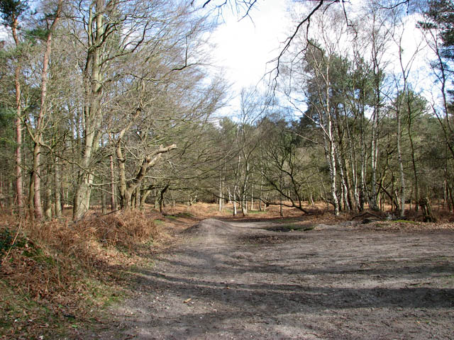
A track with obstacles
Obstacles for mountain bikers can be seen at left. This trail turns off the main footpath, leading in northerly direction.
Houghen Plantation - a woodland consisting of sections of conifers alternating with birch and sweet chestnut trees, interspersed by the occasional ancient oak - borders onto St Faith's Common and the B1149 (Holt Road) in the northeast and onto Dole Plantation and Drayton Dewray in the southwest. The woodland offers a wide range of footpaths, cycle paths and horse rides. It is traversed by an ancient lane which links the public bridleway turning off Bilney Lane in the village of Felthorpe with Sandy Lane just north of the village of Horsford.
Houghen Plantation - a woodland consisting of sections of conifers alternating with birch and sweet chestnut trees, interspersed by the occasional ancient oak - borders onto St Faith's Common and the B1149 (Holt Road) in the northeast and onto Dole Plantation and Drayton Dewray in the southwest. The woodland offers a wide range of footpaths, cycle paths and horse rides. It is traversed by an ancient lane which links the public bridleway turning off Bilney Lane in the village of Felthorpe with Sandy Lane just north of the village of Horsford.
 Map © Crown Copyright")
TIP: Click the map for more Large scale mapping
- Grid Square
- TG1717, 25 images (more nearby 🔍)
- Photographer
- Evelyn Simak (more nearby)
- Date Taken
- Sunday, 15 March, 2009 (more nearby)
- Submitted
- Monday, 16 March, 2009
- Subject Location
-
OSGB36:
 TG 175 170 [100m precision]
WGS84: 52:42.4649N 1:13.0891E - Camera Location
-
OSGB36: TG 174 170
- View Direction
- Northeast (about 45 degrees)