2003
NY9615 : End of the road
taken 21 years ago, 3 km from Bowes, County Durham, England
End of the road
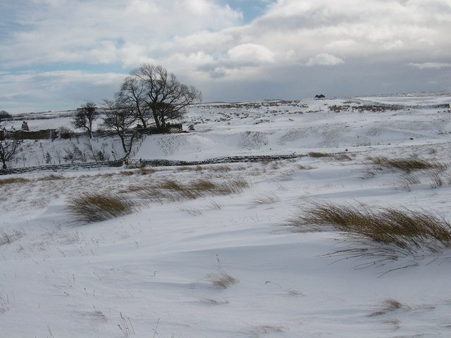
The ruined building on the left (since renovated NY9615 : House renovation with thatched roof) is at the end of the track leading down into Deepdale from West Stoney Keld. Just below the gate is the ford shown on the map (now supplemented by a footbridge) The building just visible on the horizon is a ruined barn SW of West Stoney Keld. This was a fine skiing day - becoming increasingly rare.
 Map © Crown Copyright")
TIP: Click the map for more Large scale mapping
- Grid Square
- NY9615, 7 images (more nearby 🔍)
- Photographer
- Andy Waddington (more nearby)
- Date Taken
- Monday, 3 February, 2003 (more nearby)
- Submitted
- Monday, 16 March, 2009
- Subject Location
-
OSGB36:
 NY 968 153 [100m precision]
WGS84: 54:32.0264N 2:3.0486W - Camera Location
-
OSGB36: NY 967 155
- View Direction
- South-southeast (about 157 degrees)