2009
ST9998 : Site of Smerrill Aqueduct
taken 15 years ago, near to Ewen, Gloucestershire, England
This is 1 of 2 images, with title Site of Smerrill Aqueduct in this square
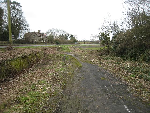
Site of Smerrill Aqueduct
The Thames & Severn Canal used to cross the A429 Cirencester - Kemble road at this point on Smerrill Aqueduct. The aqueduct and much of the embankment on either side have been removed and the road since re-aligned however remains are still visible. Here the old road alignment can be seen along with the remains of the aqueduct footings.
 Map © Crown Copyright")
TIP: Click the map for more Large scale mapping
- Grid Square
- ST9998, 54 images (more nearby 🔍)
- Photographer
- David Stowell (more nearby)
- Date Taken
- Thursday, 12 March, 2009 (more nearby)
- Submitted
- Tuesday, 17 March, 2009
- Subject Location
-
OSGB36:
 ST 997 988 [100m precision]
WGS84: 51:41.2774N 2:0.3443W - Camera Location
-
OSGB36: ST 997 988
- View Direction
- SOUTH (about 180 degrees)