2009
TM0733 : Up the Riber
taken 15 years ago, near to East Bergholt, Suffolk, England
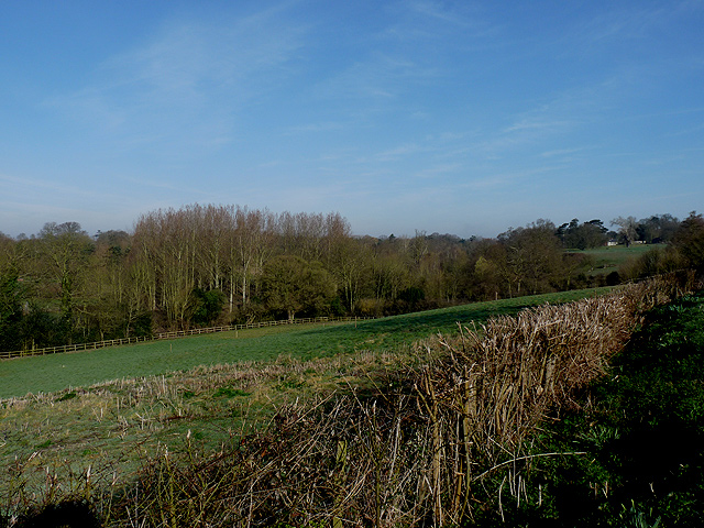
Up the Riber
.. valley, as seen from the first part of the one-way section of Flatford Lane. The Riber is a small stream, which joins the Stour just upstream from Flatford. Its narrow valley, running south from the heart of East Bergholt, contrasts with the wide Stour valley that it meets near this point.
 Map © Crown Copyright")
TIP: Click the map for more Large scale mapping
- Grid Square
- TM0733, 362 images (more nearby 🔍)
- Photographer
- Zorba the Geek (more nearby)
- Date Taken
- Wednesday, 18 March, 2009 (more nearby)
- Submitted
- Wednesday, 18 March, 2009
- Subject Location
-
OSGB36:
 TM 076 339 [100m precision]
WGS84: 51:57.9256N 1:1.2313E - Camera Location
-
OSGB36: TM 076 338
- View Direction
- Northwest (about 315 degrees)