2009
SE0974 : Opening within field wall near Middlesmoor boundary sign
taken 15 years ago, near to Middlesmoor, North Yorkshire, England
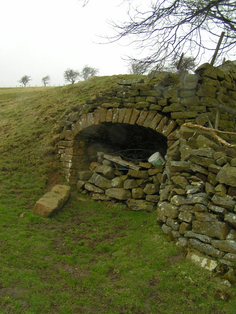
Opening within field wall near Middlesmoor boundary sign
This opening may be an elaborate water trough, or possibly the entrance to an old drift mine ?
 Map © Crown Copyright")
TIP: Click the map for more Large scale mapping
- Grid Square
- SE0974, 82 images (more nearby 🔍)
- Photographer
- Michael Steele (more nearby)
- Date Taken
- Friday, 13 March, 2009 (more nearby)
- Submitted
- Wednesday, 18 March, 2009
- Subject Location
-
OSGB36:
 SE 090 741 [100m precision]
WGS84: 54:9.7738N 1:51.7370W - Camera Location
-
OSGB36: SE 090 740
- View Direction
- North-northeast (about 22 degrees)