2009
SE1422 : Former mill building, Wharf Street, Brighouse
taken 15 years ago, near to Brighouse, Calderdale, England
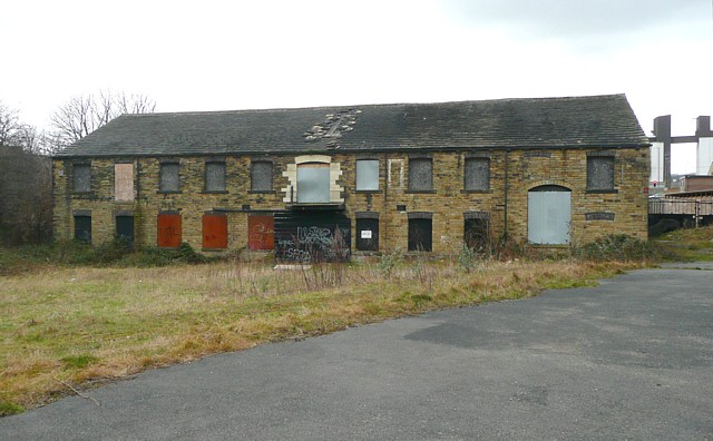
Former mill building, Wharf Street, Brighouse
Captioned 'Lower Mill (Whiting)' on the 1:500 OS plan of 1893). The mill race went underneath the building to the left of centre. Whilst the tall 'tower block' nearby has become apartments, this more modest building awaits a new use - or demolition.
 Map © Crown Copyright")
TIP: Click the map for more Large scale mapping
- Grid Square
- SE1422, 1144 images (more nearby 🔍)
- Photographer
- Humphrey Bolton (more nearby)
- Date Taken
- Monday, 2 March, 2009 (more nearby)
- Submitted
- Thursday, 19 March, 2009
- Subject Location
-
OSGB36:
 SE 147 226 [100m precision]
WGS84: 53:41.9780N 1:46.7295W - Camera Location
-
OSGB36: SE 148 226
- View Direction
- WEST (about 270 degrees)