2009
TQ6966 : Upper Bush
taken 15 years ago, near to Cuxton, Medway, England
This is 1 of 3 images, with title Upper Bush in this square
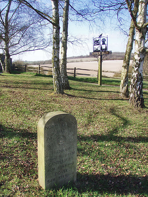
Upper Bush
North Downs Way milestone in the centre of this lovely hamlet.
 Map © Crown Copyright")
TIP: Click the map for more Large scale mapping
- Grid Square
- TQ6966, 65 images (more nearby 🔍)
- Photographer
- Andy Stephenson (more nearby)
- Date Taken
- Sunday, 22 March, 2009 (more nearby)
- Submitted
- Monday, 30 March, 2009
- Subject Location
-
OSGB36:
 TQ 69535 66842 [1m precision]
WGS84: 51:22.5193N 0:26.0688E - Camera Location
-
OSGB36: TQ 69535 66842
- View Direction
- North-northeast (about 22 degrees)