2009
NS3680 : Moorland near Mullour on Overton Muir
taken 15 years ago, near to Alexandria, West Dunbartonshire, Scotland
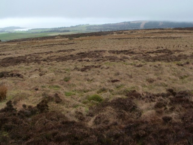
Moorland near Mullour on Overton Muir
The name Mullour is shown on the 1:25000 map (the OS Object Name Book also gives an alternative spelling, "Millaur"). Although the placement of the name on that map might suggest that Mullour is located a little NW of the highest part of Overtoun Muir, older OS maps (and the Object Name Book) make it clear that the name simply refers to the summit area itself.
This area of heathland looks rather bleak, but that is partly because there is a layer of cloud sitting over the landscape, barely higher than the photographer's viewpoint.
Carman Hill (NS3779 : Ancient hill-fort on Carman Hill) is sometimes referred to locally as "Mount Mallow". That is merely a conventional spelling, since, as far as I know, the name has never appeared on a map, but has simply been preserved through oral tradition; it is stressed on the second syllable, and rhymes with "allow". I do not believe that the name properly applies to Carman Hill; rather, the name originally referred to the top of Overtoun Muir, and was presumably derived from Mullour/Millaur: see Link (in a Geograph article) for further discussion.
At the extreme left of the image, Ardmore Point can be seen jutting out into the Clyde. The wooded slopes, partly cloud-covered, that are visible on the right of the image are the Killoeter Hills.
 Map © Crown Copyright")
TIP: Click the map for more Large scale mapping
- Grid Square
- NS3680, 67 images (more nearby 🔍)
- Photographer
- Lairich Rig (more nearby)
- Date Taken
- Monday, 30 March, 2009 (more nearby)
- Submitted
- Wednesday, 1 April, 2009
- Subject Location
-
OSGB36:
 NS 3688 8001 [10m precision]
WGS84: 55:59.1151N 4:36.9778W - Camera Location
-
OSGB36: NS 3694 8001
- View Direction
- WEST (about 270 degrees)