2009
SN0716 : Waterlogged bridleway to ford crossing
taken 15 years ago, near to Llawhaden, Pembrokeshire/Sir Benfro, Wales
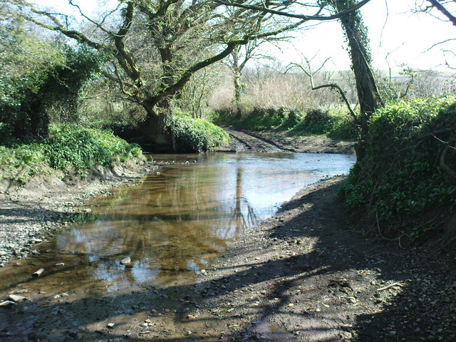
Waterlogged bridleway to ford crossing
The bridleway is very rocky all the way from the bridge near Holgan to the track/minor road to Abystree. It is waterlogged and eventually turns into a stream then crosses the stream from the East. The water was above my bike pedals in most places.
 Map © Crown Copyright")
TIP: Click the map for more Large scale mapping
- Grid Square
- SN0716, 8 images (more nearby 🔍)
- Photographer
- R Simpson (more nearby)
- Date Taken
- Thursday, 2 April, 2009 (more nearby)
- Submitted
- Friday, 3 April, 2009
- Subject Location
-
OSGB36:
 SN 076 166 [100m precision]
WGS84: 51:48.9007N 4:47.5441W - Camera Location
-
OSGB36: SN 076 166
- View Direction
- South-southeast (about 157 degrees)