2009
SE0720 : Gate Head, Stainland
taken 15 years ago, near to Stainland, Calderdale, England
This is 1 of 4 images, with title starting with Gate Head in this square
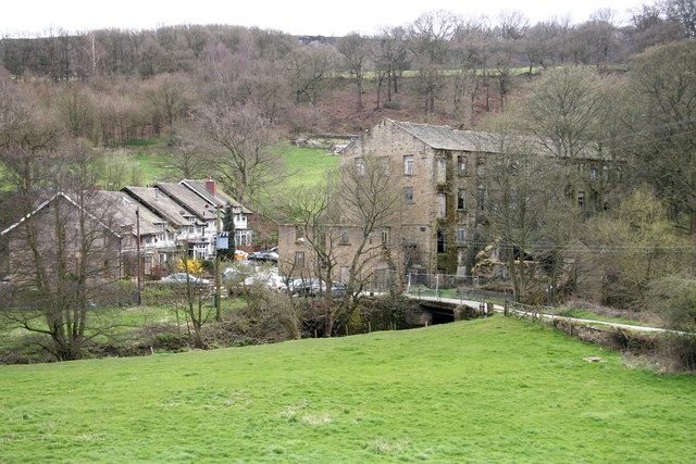
Gate Head, Stainland
The very ruinous Gatehead Mill is on the right. The place name is two words on the Land Ranger map but the mill is one word in Giles & Goodall, Yorkshire textile Mills 1770-1930. The book is a classic and a must for Yorkshire mill enthusiasts.
 Map © Crown Copyright")
TIP: Click the map for more Large scale mapping
- Grid Square
- SE0720, 119 images (more nearby 🔍)
- Photographer
- Chris Allen (more nearby)
- Date Taken
- Saturday, 4 April, 2009 (more nearby)
- Submitted
- Sunday, 5 April, 2009
- Subject Location
-
OSGB36:
 SE 077 205 [100m precision]
WGS84: 53:40.8706N 1:53.0940W - Camera Location
-
OSGB36: SE 076 206
- View Direction
- South-southeast (about 157 degrees)