2009
NH6712 : Ford, Elrick Burn
taken 15 years ago, near to Dalbeg, Highland, Scotland
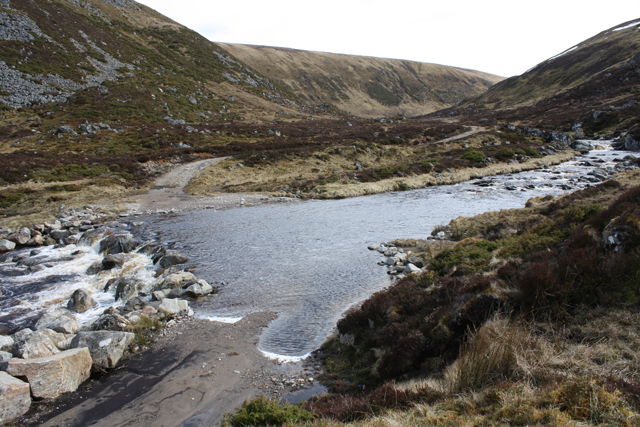
Ford, Elrick Burn
A deep ford which can be avoided by crossing a bridge downstream then wading through trackless bog to rejoin the vehicle track. The OS map is wrong here, the vehicle track carries on along the SW bank after the bridge at NH6765 1327 then crosses at this ford and continues on the NE bank. Also the footpath the map shows on the north bank is non existent. Microsoft Virtual Earth satellite image shows the detail.
 Map © Crown Copyright")
TIP: Click the map for more Large scale mapping
- Grid Square
- NH6712 (more nearby 🔍)
- Photographer
- Dorothy Carse (more nearby)
- Date Taken
- Sunday, 5 April, 2009 (more nearby)
- Submitted
- Sunday, 5 April, 2009
- Subject Location
-
OSGB36:
 NH 677 127 [100m precision]
WGS84: 57:11.2068N 4:11.3977W - Camera Location
-
OSGB36: NH 677 128
- View Direction
- East-southeast (about 112 degrees)