2009
TA1029 : Queen's Dock, Hull
taken 15 years ago, near to Kingston Upon Hull, England
This is 1 of 3 images, with title starting with Queen's Dock in this square
Queen's Dock, Hull
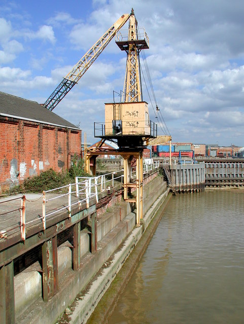
Scotch type derrick on the north side of the lockpit between the River Hull and the old Queen's Dock, looking east-northeast from Dock Office Row. The lock was operational from 1778 to 1930 when Queen's Dock was filled in and became Queen's Gardens. The lockpit was used as a dry dock from 1957 until the end of the 20th century.
 Map © Crown Copyright")
TIP: Click the map for more Large scale mapping
- Grid Square
- TA1029, 1231 images (more nearby 🔍)
- Photographer
- Paul Glazzard (more nearby)
- Date Taken
- Tuesday, 7 April, 2009 (more nearby)
- Submitted
- Wednesday, 8 April, 2009
- Subject Location
-
OSGB36:
 TA 102 291 [100m precision]
WGS84: 53:44.8086N 0:19.8064W - Camera Location
-
OSGB36: TA 102 291
- View Direction
- East-northeast (about 67 degrees)