2009
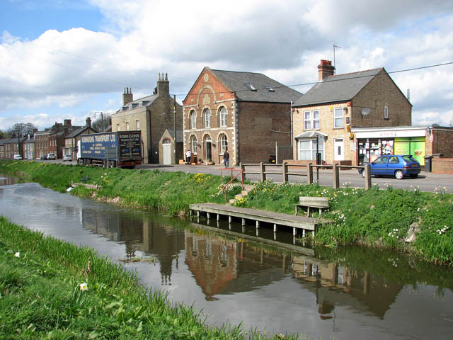
TF5002 : Methodist church on Town Street (B1412)
taken 15 years ago, near to Upwell, Norfolk, England
Methodist church on Town Street (B1412)
This view was taken across Well Creek > Link . Upwell is located on the edge of the Cambridgeshire Fens. Draining of the fens and their conversion into fertile agricultural land started in 1630 when the Dutch engineer Cornelius Vermuyden was employed by a group led by the Earl of Bedford. Despite all efforts, nature contrived to ensure that the drainage work should continue as the dry peat shrunk and further lowered the level of the land. Upwell merges with the adjoining village of Outwell, situated on the A1122 close to the Cambridgeshire border about 5 miles south of Wisbech .
 Map © Crown Copyright")
TIP: Click the map for more Large scale mapping
- Grid Square
- TF5002, 185 images (more nearby 🔍)
- Photographer
- Evelyn Simak (more nearby)
- Date Taken
- Tuesday, 7 April, 2009 (more nearby)
- Submitted
- Wednesday, 8 April, 2009
- Subject Location
-
OSGB36:
 TF 500 027 [100m precision]
WGS84: 52:36.0874N 0:12.8678E - Camera Location
-
OSGB36: TF 502 027
- View Direction
- WEST (about 270 degrees)