2004
NT1431 : Drumelzier Law
taken 20 years ago, 3 km from Stanhope, Scottish Borders, Scotland
This is 1 of 2 images, with title Drumelzier Law in this square
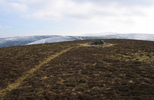
Drumelzier Law
The summit area. Constant exposure to wind keeps the vegetation close to the ground. Walk away from the ridge and deep heather returns.
 Map © Crown Copyright")
TIP: Click the map for more Large scale mapping
- Grid Square
- NT1431, 14 images (more nearby 🔍)
- Photographer
- Richard Webb (more nearby)
- Date Taken
- Tuesday, 2 March, 2004 (more nearby)
- Submitted
- Tuesday, 24 May, 2005
- Subject Location
-
OSGB36:
 NT 1493 3122 [10m precision]
WGS84: 55:34.0319N 3:21.0319W - Camera Location
-
OSGB36: NT 1491 3126
- View Direction
- South-southeast (about 157 degrees)