2006
SH9870 : Llannefydd
taken 18 years ago, near to Llannefydd, Conwy, Wales
This is 1 of 2 images, with title Llannefydd in this square
Llannefydd
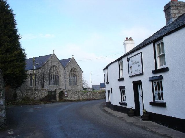
Village centre of Llannefydd with the parish church to the left and the Hawk and Buckle public house to the right
 Map © Crown Copyright")
TIP: Click the map for more Large scale mapping
- Grid Square
- SH9870, 17 images (more nearby 🔍)
- Photographer
- Dot Potter (more nearby)
- Date Taken
- Sunday, 19 February, 2006 (more nearby)
- Submitted
- Sunday, 19 February, 2006
- Subject Location
-
OSGB36:
 SH 982 705 [100m precision]
WGS84: 53:13.3491N 3:31.5551W - Camera Location
-
OSGB36: SH 982 705
- View Direction
- West-northwest (about 292 degrees)