2009
SY9898 : Brog Street in Spring
taken 15 years ago, near to East End, Dorset, England
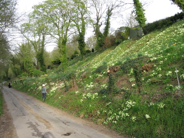
Brog Street in Spring
In an 1813 Inclosure map, Brog Street is shown as the main road to Wimborne from the South West, before the A31 and the Somerset and Dorset Railway were thought of. The embankment which the primroses like was built around 1850 for the railway, which was closed around 1960. A house has now been built on the railway, the owners have worked hard to plant daffodils and primroses, a marvellous sight in springtime. Today, Brog Street is a funny little road that winds between banks and under disused bridges, hardly room for two cars to pass. Once a satnav-misdirected juggernaut had to back because the bridge was too low.
 Map © Crown Copyright")
TIP: Click the map for more Large scale mapping
- Grid Square
- SY9898, 40 images (more nearby 🔍)
- Photographer
- John Palmer (more nearby)
- Date Taken
- Tuesday, 14 April, 2009 (more nearby)
- Submitted
- Tuesday, 14 April, 2009
- Subject Location
-
OSGB36:
 SY 986 986 [100m precision]
WGS84: 50:47.2235N 2:1.2481W - Camera Location
-
OSGB36: SY 985 985
- View Direction
- East-northeast (about 67 degrees)