2009
TQ0805 : Water Lane
taken 15 years ago, near to Clapham, West Sussex, England
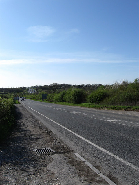
Water Lane
The A280 heading west to Angmering. The road didn't exist until the 19th century when it was added to make coach access easy to Clapham and all routes north. It remained a main road into Angmering and was improved in the 1990s with a by-pass added heading south in 2003. The dual carriageway in the distance is the A27, again a new route built in the 1990s to replace the single lane road that existed between the junction with Longfurlong, the northern route of the A280, and Hammerpot.
 Map © Crown Copyright")
TIP: Click the map for more Large scale mapping
- Grid Square
- TQ0805, 60 images (more nearby 🔍)
- Photographer
- Simon Carey (more nearby)
- Date Taken
- Monday, 13 April, 2009 (more nearby)
- Submitted
- Friday, 17 April, 2009
- Subject Location
-
OSGB36:
 TQ 086 054 [100m precision]
WGS84: 50:50.2929N 0:27.5262W - Camera Location
-
OSGB36: TQ 089 053
- View Direction
- West-northwest (about 292 degrees)