SJ7459 : Wheelock Rail Trail
taken 15 years ago, near to Wheelock, Cheshire East, England
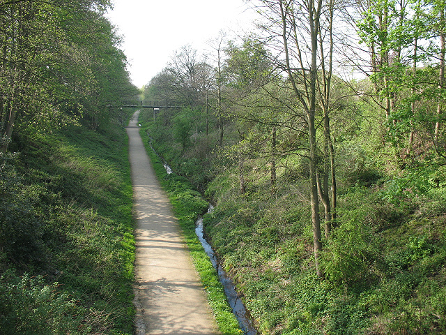
The 2km pedestrian and cycle route follows part of the route of a former railway between Sandbach and Harecastle (originally part of the North Staffordshire Railway's intended main line to Liverpool). There were passenger stations at Wheelock, Hassall Green and Lawton, but passenger services ceased as early as 1930 and it was always primarily a goods line. It supplied coal and limestone to local industries including salt works at Wheelock and Malkins Bank, and soap and detergent manufacture; it also carried products from the Staffordshire Potteries towards Liverpool. Goods traffic finally ceased in 1971, relatively late for a single-track freight branch. The section of the route between Sandbach station and the start of the trail has been used for a road; at the other end it connects with the Salt Line (another section of the former railway, towards Hassall Green).
A more detailed history of the line by John Owen can be downloaded from Link
 Map © Crown Copyright")
- Grid Square
- SJ7459, 64 images (more nearby 🔍)
- Photographer
- Stephen Craven (more nearby)
- Date Taken
- Saturday, 18 April, 2009 (more nearby)
- Submitted
- Monday, 20 April, 2009
- Subject Location
-
OSGB36:
 SJ 749 596 [100m precision]
WGS84: 53:7.9941N 2:22.5518W - Camera Location
-
OSGB36: SJ 749 596
- View Direction
- Northwest (about 315 degrees)