2009
NT1271 : Lane at Claylands
taken 15 years ago, near to Ratho Station, Edinburgh, Scotland
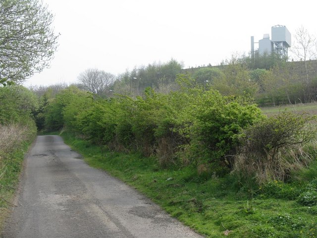
Lane at Claylands
A cul-de-sac, but within earshot of the M8 junction with the M9, so not as peaceful as it might look. The structure on the right is at Hillwood Quarry, although not immediately apparent in Richard Webb's aerial photograph NT1271 : Hillwood Quarry.
 Map © Crown Copyright")
TIP: Click the map for more Large scale mapping
- Grid Square
- NT1271, 43 images (more nearby 🔍)
- Photographer
- M J Richardson (more nearby)
- Date Taken
- Saturday, 25 April, 2009 (more nearby)
- Submitted
- Monday, 27 April, 2009
- Subject Location
-
OSGB36:
 NT 125 719 [100m precision]
WGS84: 55:55.9518N 3:24.1269W - Camera Location
-
OSGB36: NT 124 719
- View Direction
- Northeast (about 45 degrees)