2008
NB5231 : Upper Bayble
taken 15 years ago, near to Upper Bayble, Isle of Lewis And Harris, Na h-Eileanan an Iar, Scotland
Upper Bayble
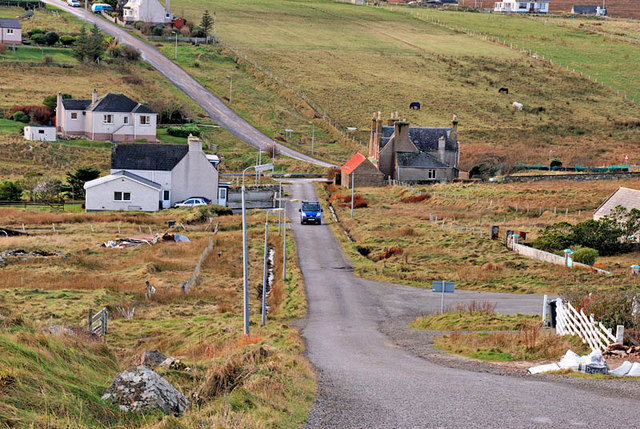
A view from Upper Bayble to the junction at the bottom of the hill. The road to the pier is out of shot to the left behind the first white house.
 Map © Crown Copyright")
TIP: Click the map for more Large scale mapping
- Grid Square
- NB5231, 11 images (more nearby 🔍)
- Photographer
- Stephen Branley (more nearby)
- Date Taken
- Wednesday, 3 December, 2008 (more nearby)
- Submitted
- Thursday, 30 April, 2009
- Subject Location
-
OSGB36:
 NB 524 316 [100m precision]
WGS84: 58:12.2298N 6:12.8934W - Camera Location
-
OSGB36: NB 526 316
- View Direction
- WEST (about 270 degrees)