2009
NG1896 : Sgeir Ghlas and Sgeotasaigh
taken 15 years ago, near to Carragreich, Isle of Lewis And Harris, Na h-Eileanan an Iar, Scotland
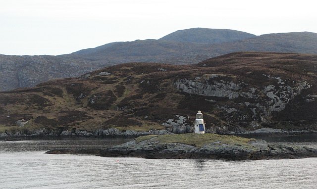
Sgeir Ghlas and Sgeotasaigh
Beyond the light on Sgeir Ghlas is the heathery small island of Sgeotasaigh and the heathery large island of Harris. Sgeotasaigh, alternative spelling Scotasay is an uninhabited island just under 1km² in area.
Sgeir Ghlas is a tiny skerry with just a small area of gull fertilised grass surrounding the light.
Sgeir Ghlas is a tiny skerry with just a small area of gull fertilised grass surrounding the light.
 Map © Crown Copyright")
TIP: Click the map for more Large scale mapping
- Grid Square
- NG1896, 18 images (more nearby 🔍)
- Photographer
- Richard Webb (more nearby)
- Date Taken
- Monday, 13 April, 2009 (more nearby)
- Submitted
- Friday, 8 May, 2009
- Subject Location
-
OSGB36:
 NG 182 969 [100m precision]
WGS84: 57:52.3633N 6:45.2299W - Camera Location
-
OSGB36: NG 180 967
- View Direction
- Northeast (about 45 degrees)