2008
SH6456 : Llyn Cwmffynnon
taken 16 years ago, 4 km S of Pont Pen-y-Benglog, Conwy, Wales
This is 1 of 10 images, with title Llyn Cwmffynnon in this square
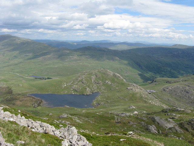
Llyn Cwmffynnon
Heading off Glyder Fawr on a poorly marked path which goes to the right of Llyn Cwmffynnon and aiming for Pen y Pass. Pen y Pass can be seen lower middle right with the miners track to Snowdon going up to the right, the pyg track can be seen faintly below it in the picture. Although in fact the pyg track gains height much quicker and is the fastest way up Snowdon.
 Map © Crown Copyright")
TIP: Click the map for more Large scale mapping
- Grid Square
- SH6456, 39 images (more nearby 🔍)
- Photographer
- Tony Edwards (more nearby)
- Date Taken
- Wednesday, 14 May, 2008 (more nearby)
- Submitted
- Saturday, 9 May, 2009
- Subject Location
-
OSGB36:
 SH 648 563 [100m precision]
WGS84: 53:5.2110N 4:1.1555W - Camera Location
-
OSGB36: SH 640 566
- View Direction
- East-southeast (about 112 degrees)