2006
SX9187 : Dadmouth, nr Kennford
taken 18 years ago, near to Shillingford st George, Devon, England
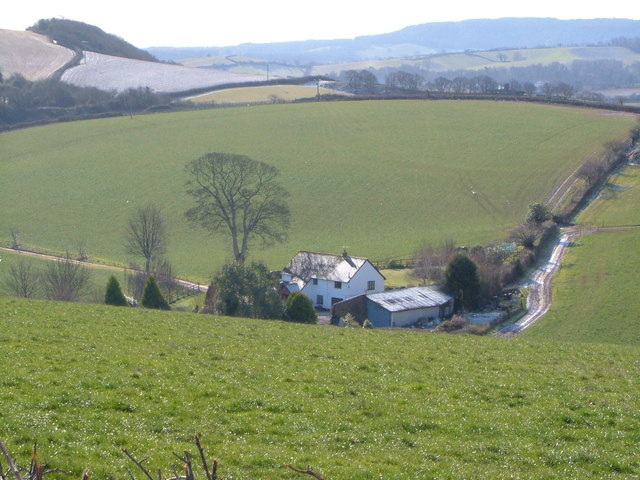
Dadmouth, nr Kennford
Lying in one of two deep valleys crossing this square, Dadmouth looks remote, but the hedge on the left marks the A379, near its junction with the A38 expressway. View looking SSE from Shillingford St George Bridleway 19. In the background, the Haldon hills. 10:18 am.
 Map © Crown Copyright")
TIP: Click the map for more Large scale mapping
- Grid Square
- SX9187, 27 images (more nearby 🔍)
- Photographer
- Derek Harper (more nearby)
- Date Taken
- Thursday, 2 March, 2006 (more nearby)
- Submitted
- Thursday, 2 March, 2006
- Subject Location
-
OSGB36:
 SX 915 875 [100m precision]
WGS84: 50:40.6209N 3:32.2183W - Camera Location
-
OSGB36: SX 914 877
- View Direction
- South-southeast (about 157 degrees)