2009
SC1971 : The flank of Bradda Hill
taken 15 years ago, near to Ballafesson, Isle of Man
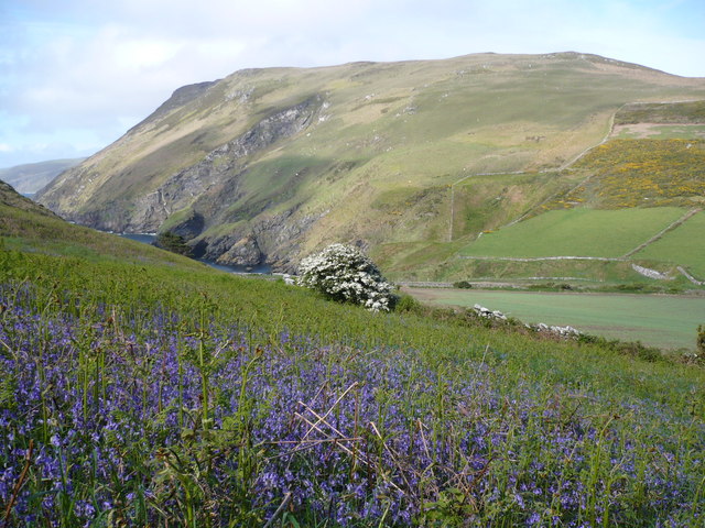
The flank of Bradda Hill
The photo was taken from the footpath that comes down from Bradda Hill above Fleshwick Bay.
 Map © Crown Copyright")
TIP: Click the map for more Large scale mapping
- Grid Square
- SC1971, 14 images (more nearby 🔍)
- Photographer
- Phil Catterall (more nearby)
- Date Taken
- Saturday, 16 May, 2009 (more nearby)
- Submitted
- Saturday, 23 May, 2009
- Subject Location
-
OSGB36:
 SC 1994 7126 [10m precision]
WGS84: 54:6.3373N 4:45.3390W - Camera Location
-
OSGB36: SC 1988 7117
- View Direction
- Northeast (about 45 degrees)