2009
SH6145 : Drovers Road
taken 15 years ago, near to Nantmor, Gwynedd, Wales
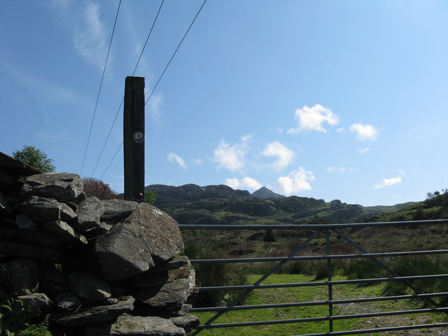
Drovers Road
This is part of the drovers road from Nantmor to Croesor which crosses the lower slopes of Cnicht which is the peak centre picture.
 Map © Crown Copyright")
TIP: Click the map for more Large scale mapping
- Grid Square
- SH6145, 17 images (more nearby 🔍)
- Photographer
- Tony Edwards (more nearby)
- Date Taken
- Sunday, 24 May, 2009 (more nearby)
- Submitted
- Monday, 25 May, 2009
- Subject Location
-
OSGB36:
 SH 613 451 [100m precision]
WGS84: 52:59.1356N 4:4.0540W - Camera Location
-
OSGB36: SH 612 451
- View Direction
- East-northeast (about 67 degrees)