2009
SX9076 : The valley of the Moor Brook
taken 15 years ago, near to Luton, Devon, England
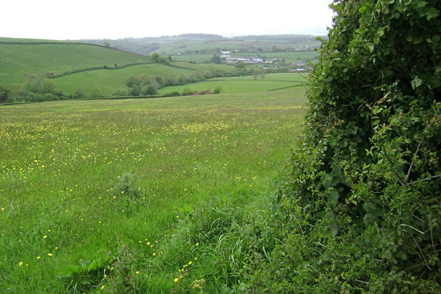
The valley of the Moor Brook
The Moor Brook flows down from Little Haldon to Luton, upper right, where there is a ford SX9076 : Ford at Luton, Devon SX9076 : Ford at Luton in Devon. Westhayes Farm to the left is in SX8976. Higher Barn, above centre, is a ruin.
 Map © Crown Copyright")
TIP: Click the map for more Large scale mapping
- Grid Square
- SX9076, 87 images (more nearby 🔍)
- Photographer
- Robin Stott (more nearby)
- Date Taken
- Monday, 18 May, 2009 (more nearby)
- Submitted
- Monday, 25 May, 2009
- Subject Location
-
OSGB36:
 SX 907 765 [100m precision]
WGS84: 50:34.6788N 3:32.7026W - Camera Location
-
OSGB36: SX 909 765
- View Direction
- WEST (about 270 degrees)