2009
NY2677 : Kirtle Water near Waterbeck
taken 15 years ago, near to Waterbeck, Dumfries And Galloway, Scotland
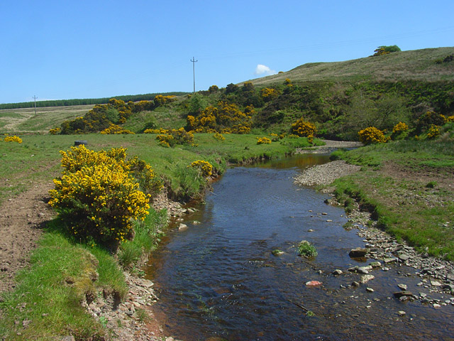
Kirtle Water near Waterbeck
In pasture below Hotts Farm with the forestry on High Muir in the background. Just the remnants of a footbridge remain just upstream of this position.
 Map © Crown Copyright")
TIP: Click the map for more Large scale mapping
- Grid Square
- NY2677, 3 images (more nearby 🔍)
- Photographer
- Andrew Smith (more nearby)
- Date Taken
- Sunday, 24 May, 2009 (more nearby)
- Submitted
- Wednesday, 27 May, 2009
- Subject Location
-
OSGB36:
 NY 2610 7788 [10m precision]
WGS84: 55:5.3896N 3:9.5624W - Camera Location
-
OSGB36: NY 2603 7788
- View Direction
- EAST (about 90 degrees)