2009
TA1130 : Holderness Road
taken 15 years ago, near to Marfleet, Kingston Upon Hull, England
This is 1 of 2 images, with title Holderness Road in this square
Holderness Road
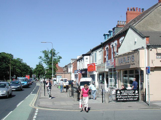
Looking northeast across the junction of Jesmond Gardens from outside Teddys Amusements at No.326a Holderness Road. Marleys Cafe Bar at No.328 on the right was until fairly recently a rather grim looking pub (or club) called the Jesmond Arms. Holderness Road is one of Hull's main traffic routes and a busy out-of-town shopping area.
 Map © Crown Copyright")
TIP: Click the map for more Large scale mapping
- Grid Square
- TA1130, 858 images (more nearby 🔍)
- Photographer
- Paul Glazzard (more nearby)
- Date Taken
- Friday, 29 May, 2009 (more nearby)
- Submitted
- Sunday, 31 May, 2009
- Subject Location
-
OSGB36:
 TA 115 302 [100m precision]
WGS84: 53:45.3840N 0:18.5367W - Camera Location
-
OSGB36: TA 115 302
- View Direction
- Northeast (about 45 degrees)