2006
SO2927 : Footpath to Maes-y-Beran
taken 18 years ago, near to Llanthony, Monmouthshire/Sir Fynwy, Wales
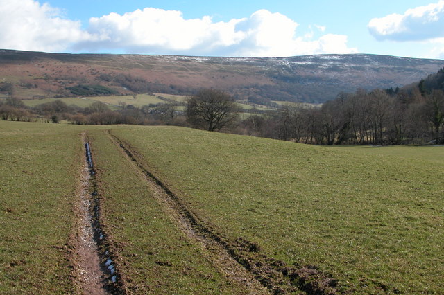
Footpath to Maes-y-Beran
Looking south down to the Vale of Ewyas to the steep sides of the Black Mountains, the slightly higher ground on the horizon is Hatterrall Hill. This footpath is just south of Llanthony.
 Map © Crown Copyright")
TIP: Click the map for more Large scale mapping
- Grid Square
- SO2927, 37 images (more nearby 🔍)
- Photographer
- Philip Halling (more nearby)
- Date Taken
- Saturday, 4 March, 2006 (more nearby)
- Submitted
- Monday, 6 March, 2006
- Subject Location
-
OSGB36:
 SO 290 274 [100m precision]
WGS84: 51:56.4446N 3:1.9853W - Camera Location
-
OSGB36: SO 290 274
- View Direction
- Southeast (about 135 degrees)