2009
J4792 : The Old Castle Road, Whitehead
taken 15 years ago, near to Whitehead, Co Antrim, Northern Ireland
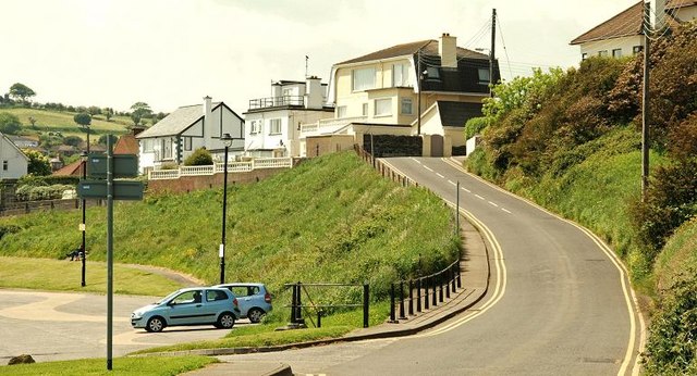
The Old Castle Road, Whitehead
A steep road, running from The Banks towards Chester Avenue J4792 : Chester Avenue, Whitehead and the Islandmagee Road.
The Blackhead Path, Whitehead
A path running from The Banks at Whitehead, along the shore, to the Blackhead Lighthouse (with a parallel path running inland along the cliff and higher ground). It is possible to walk back to Whitehead from the lighthouse, on a surfaced path, via Muldersleigh Hill, McCreas Brae and the Islandmagee Road. Steep in places and not suitable for wheelchairs.
Loading map... (JavaScript required)
- Grid Square
- J4792, 95 images (more nearby 🔍)
- Photographer
- Albert Bridge (more nearby)
- Date Taken
- Wednesday, 3 June, 2009 (more nearby)
- Submitted
- Thursday, 4 June, 2009
- Subject Location
-
Irish:
 J 477 921 [100m precision]
WGS84: 54:45.3333N 5:42.3544W - Camera Location
-
Irish: J 478 922
- View Direction
- West-southwest (about 247 degrees)