1974
TQ5778 : West Thurrock Cement Industry, 1974
taken 50 years ago, near to West Thurrock, Thurrock, England
This is 1 of 2 images, with title West Thurrock Cement Industry, 1974 in this square
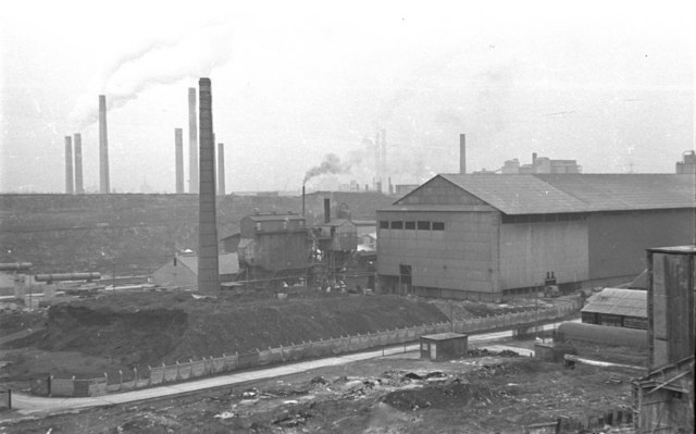
West Thurrock Cement Industry, 1974
Looking SE from Stonehouse Lane across cement works either side of the A282 Dartford Tunnel Approach road. In the foreground is the Lafarge works west of the A282
 Map © Crown Copyright")
TIP: Click the map for more Large scale mapping
- Grid Square
- TQ5778, 36 images (more nearby 🔍)
- Photographer
- Pierre Terre (more nearby)
- Date Taken
- Monday, 25 February, 1974 (more nearby)
- Submitted
- Wednesday, 8 March, 2006
- Subject Location
-
OSGB36:
 TQ 573 782 [100m precision]
WGS84: 51:28.8532N 0:15.8329E - Camera Location
-
OSGB36: TQ 571 784