2009
NS3779 : Carman Hill-fort: eastern wall of annexe
taken 15 years ago, near to Alexandria, West Dunbartonshire, Scotland
This is 1 of 2 images, with title Carman Hill-fort: eastern wall of annexe in this square
Carman Hill-fort: eastern wall of annexe
See NS3779 : Ancient hill-fort on Carman Hill for the main description of the hill-fort. Click on the end-note title for related pictures, and see the annotated satellite view linked from the end-note as an index to these pictures and their positions in the fort.
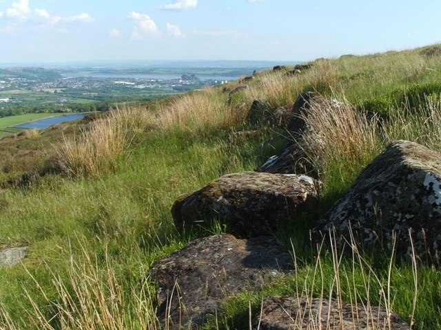
The fort has an annexe on its eastern side. The present picture shows part of its eastern (or outer) wall.
This photo shows the same wall as the previous item, but from a position further along its course. The same wall is shown in NS3779 : Carman Hill-fort: eastern wall of annexe, but the present picture was taken from further ahead.
Other pictures of the annexe:
NS3779 : Carman Hill-fort: northern end of annexe
NS3779 : Carman Hill-fort: western wall of annexe
NS3779 : Carman Hill-fort: western wall of annexe
NS3779 : Carman Hill-fort: eastern wall of annexe
Next topic sunken approach road:
NS3779 : Carman Hill-fort: sunken approach road
NS3779 : Carman Hill-fort: sunken approach road
Previous topic the inner enclosure:
NS3779 : Carman Hill-fort: line of inner enclosure
NS3779 : Carman Hill-fort: line of inner enclosure
NS3779 : Carman Hill-fort: line of inner enclosure
NS3779 : Carman Hill-fort: line of inner enclosure
NS3779 : Carman Hill-fort: line of inner enclosure
Carman Hill-fort
This large hill-fort see Link
(at Canmore) was identified in 1954 from aerial photographs, and is thought to date from the Early Historic period (Dark Ages). See Link for a Geograph article on the fort. See Link
 Map © Crown Copyright")
TIP: Click the map for more Large scale mapping
- Grid Square
- NS3779, 116 images (more nearby 🔍)
- Photographer
- Lairich Rig (more nearby)
- Date Taken
- Monday, 1 June, 2009 (more nearby)
- Submitted
- Wednesday, 10 June, 2009
- Subject Location
-
OSGB36:
 NS 3728 7947 [10m precision]
WGS84: 55:58.8325N 4:36.5739W - Camera Location
-
OSGB36: NS 3727 7949
- View Direction
- South-southeast (about 157 degrees)