2009
NG2645 : Dried up bog
taken 15 years ago, near to Lonmore, Isle of Skye, Scotland
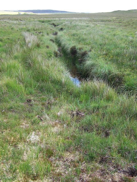
Dried up bog
The thick moss in the foreground would normally be boggy and unsafe to walk on, but after three weeks of rain-free, sunny weather, it is soft but dry.
See John Allan's picture of this moor in winter - NG2645 : Peat Bog .
The burn, almost hidden in the lush vegetation, is the Allt an Loin.
See John Allan's picture of this moor in winter - NG2645 : Peat Bog .
The burn, almost hidden in the lush vegetation, is the Allt an Loin.
 Map © Crown Copyright")
TIP: Click the map for more Large scale mapping
- Grid Square
- NG2645, 13 images (more nearby 🔍)
- Photographer
- Richard Dorrell (more nearby)
- Date Taken
- Monday, 15 June, 2009 (more nearby)
- Submitted
- Monday, 15 June, 2009
- Subject Location
-
OSGB36:
 NG 265 452 [100m precision]
WGS84: 57:24.8880N 6:33.3514W - Camera Location
-
OSGB36: NG 265 452
- View Direction
- EAST (about 90 degrees)