2009
NY6686 : Cranecleugh footbridge
taken 15 years ago, near to Bullcrag Edge [hill or Mountain], Northumberland, Great Britain
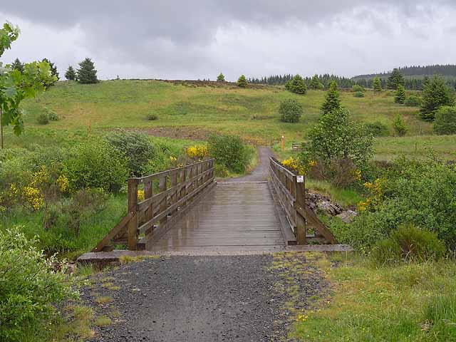
Cranecleugh footbridge
The Lakeside Way is an ambitious recently-completed project (2006-2009) to provide a multi-user track all the way round Kielder Water (42 Km in all). Throughout almost its entire length, it runs on the lakeward side of the public road on the south shore, and the bridleway on the north shore. Here, on the south shore, it crosses Cranecleugh Burn a short way downstream from the road bridge.
 Map © Crown Copyright")
TIP: Click the map for more Large scale mapping
- Grid Square
- NY6686, 21 images (more nearby 🔍)
- Photographer
- Oliver Dixon (more nearby)
- Date Taken
- Thursday, 18 June, 2009 (more nearby)
- Submitted
- Saturday, 20 June, 2009
- Subject Location
-
OSGB36:
 NY 666 861 [100m precision]
WGS84: 55:10.1064N 2:31.4950W - Camera Location
-
OSGB36: NY 666 861
- View Direction
- Southeast (about 135 degrees)