2006
ST6297 : Sluice Gate
taken 18 years ago, near to Shepperdine, South Gloucestershire, England
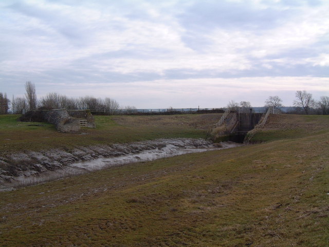
Sluice Gate
Looking east from the riverbank path. This sluice gate was constructed to prevent the high tides of the River Severn from flooding the farmland of the Vale of Berkeley.
 Map © Crown Copyright")
TIP: Click the map for more Large scale mapping
- Grid Square
- ST6297, 12 images (more nearby 🔍)
- Photographer
- David Exworth (more nearby)
- Date Taken
- Monday, 13 March, 2006 (more nearby)
- Submitted
- Monday, 13 March, 2006
- Subject Location
-
OSGB36:
 ST 627 971 [100m precision]
WGS84: 51:40.2855N 2:32.4465W