2009
NO4102 : Hatton and Keil Burns at Lower Largo
taken 15 years ago, near to Lower Largo, Fife, Scotland
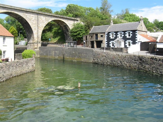
Hatton and Keil Burns at Lower Largo
The two burns join about 500m upstream, but seem not to have a single name after the confluence - here they are tidal. The road under the disused railway viaduct leads up to the A915 Leven - St Andrews road.
 Map © Crown Copyright")
TIP: Click the map for more Large scale mapping
- Grid Square
- NO4102, 322 images (more nearby 🔍)
- Photographer
- M J Richardson (more nearby)
- Date Taken
- Monday, 22 June, 2009 (more nearby)
- Submitted
- Tuesday, 23 June, 2009
- Subject Location
-
OSGB36:
 NO 417 026 [100m precision]
WGS84: 56:12.7547N 2:56.4525W - Camera Location
-
OSGB36: NO 416 025
- View Direction
- Northeast (about 45 degrees)