2009
NH2794 : Loch an Daimh
taken 15 years ago, near to Loch an Daimh [water Feature], Highland, Great Britain
This is 1 of 2 images, with title Loch an Daimh in this square
Loch an Daimh
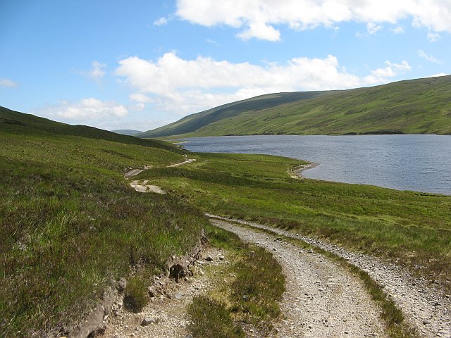
The road beside the loch forks, this branch climbing to cross the watershed above its 220m low point and a rougher track running beside the water.
View along the loch towards Mullach a' Chadha Bhuidhe.
View along the loch towards Mullach a' Chadha Bhuidhe.
 Map © Crown Copyright")
TIP: Click the map for more Large scale mapping
- Grid Square
- NH2794, 4 images (more nearby 🔍)
- Photographer
- Richard Webb (more nearby)
- Date Taken
- Thursday, 25 June, 2009 (more nearby)
- Submitted
- Sunday, 28 June, 2009
- Subject Location
-
OSGB36:
 NH 279 946 [100m precision]
WGS84: 57:54.4492N 4:54.3723W - Camera Location
-
OSGB36: NH 275 945
- View Direction
- EAST (about 90 degrees)