2009
TM1895 : Tharston Water Mill
taken 15 years ago, near to Hapton, Norfolk, England
This is 1 of 2 images, with title Tharston Water Mill in this square
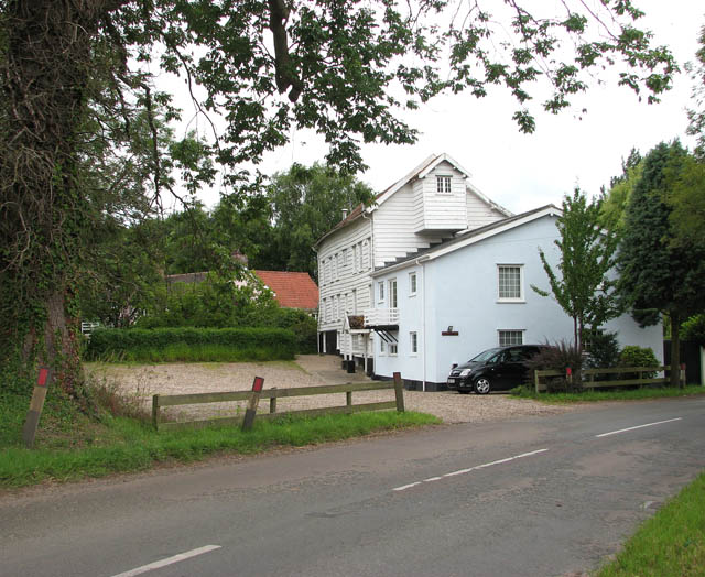
Tharston Water Mill
Tharston watermill is built of weatherboard and has a Norfolk pantiled roof. In the early 1800s the mill was primarily producing flour. The mill was remodelled in 1952 and its capacity was doubled. It was closed in 1970 and has since been converted to private accommodation.
 Map © Crown Copyright")
TIP: Click the map for more Large scale mapping
- Grid Square
- TM1895, 28 images (more nearby 🔍)
- Photographer
- Evelyn Simak (more nearby)
- Date Taken
- Thursday, 9 July, 2009 (more nearby)
- Submitted
- Friday, 10 July, 2009
- Subject Location
-
OSGB36:
 TM 181 959 [100m precision]
WGS84: 52:31.0820N 1:12.7862E - Camera Location
-
OSGB36: TM 181 959
- View Direction
- West-northwest (about 292 degrees)