Geograph - photograph every grid square
2009
TQ2053
: Headley Heath
taken
15 years ago
,
near
to
Headley
, Surrey, England
This is 1 of
10 images, with title Headley Heath
in this square
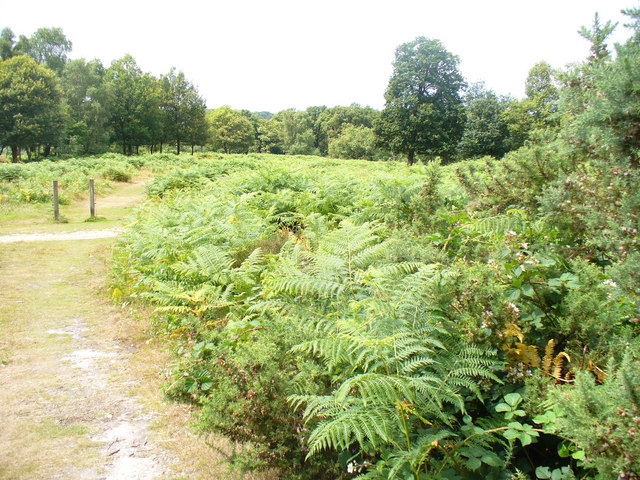
Headley Heath
Sandy and hilly area of the North Downs, poor soils, deciduous woodland with bracken infestations on the heathland.
© Copyright
Colin Smith
and licensed for
reuse
under this
Creative Commons Licence
.
Licensing
Download
Share...
Share this photo via Twitter
Share this photo via Facebook
Share this photo via Pinterest
Share this photo via Flipboard
Share this photo via email/e-card
Grab a Stamped/Watermarked Image
Mark
👍🏻
Like Image
👍🏻
Like Description
Update Information
Contact Contributor
Category:
Heathland
>
Heathland
This photo is linked from:
Articles
: ·
Collaborative Landforms Gallery
Title Clusters
: ·
Headley Heath [10]
·
TIP: Click the map for more Large scale mapping
Grid Square
TQ2053
, 62 images (
more nearby
🔍
)
Photographer
Colin Smith
(
more nearby
)
Date Taken
Friday, 10 July, 2009 (
more nearby
)
Submitted
Sunday, 12 July, 2009
Subject Location
OSGB36:
TQ 203 537
[100m precision]
WGS84:
51:16.1913N
0:16.6163W
Camera Location
OSGB36:
TQ 203 537
View Direction
West-southwest (about 247 degrees)
NW
N
NE
W
Go
E
SW
S
SE
Discuss TQ2053
View this location on ...
Geograph Coverage Map (includes OSM etc)
Geograph Links Page
Open in Google Maps
Navigate to location with Google Maps
Open in Google Earth Pro
Open in Google Earth for Web
Open in Bing Maps
Navigate with Google Maps
Lookup nearest Postcode
Image classification
(about)
: Geograph (Third Visitor for TQ2053)
This page has been
viewed
about
51
times
☰
Home
View
Search
Marked Images
Maps
Browser
Explore
Showcase
New Images
Collections
Interact
Games
Discussions
Blog
Contributors
Submit
Statistics
Leaderboards
General
FAQ
Help Pages
Sitemap
Contact Us
Support Us
sponsored by
🔍
What to search:
Photos
Enter keywords or a location/postcode to search nearby images
Photos near TQ2053
Enter a Grid Reference
Placenames
Collections
Website Pages
Everything
Others:
Advanced Search
|
Image Browser
Or:
Coverage Map
|
Searchable Map
You are not logged in
login
|
register