2009
SP5076 : Across the black path footbridge
taken 15 years ago, near to Rugby, Warwickshire, England
Across the black path footbridge
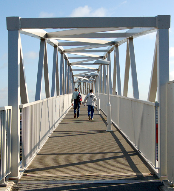
Looking north along the footbridge carrying the 'black path' over the west coast mainline railway west of Rugby station.
This bridge replaces an earlier rivetted footbridge and it opened in mid-summer 2009, the replacement project having over-run by several months. The 'black path' and footbridge connects the town centre to the substantial housing estates at Brownsover and was once the main pedestrian route from the town to the now-demolished engineering works.
For a view of the old bridge and engineering works before demolition see [Link] .
For a view of the new bridge under construction see [Link] .
For a view of the demolished site of the former engineering works see [Link] .
 Map © Crown Copyright")
TIP: Click the map for more Large scale mapping
- Grid Square
- SP5076, 198 images (more nearby 🔍)
- Photographer
- Andy F (more nearby)
- Date Taken
- Monday, 13 July, 2009 (more nearby)
- Submitted
- Monday, 13 July, 2009
- Subject Location
-
OSGB36:
 SP 505 760 [100m precision]
WGS84: 52:22.8149N 1:15.5012W - Camera Location
-
OSGB36: SP 505 760
- View Direction
- North-northeast (about 22 degrees)