2009
SX9066 : Torquay cemetery
taken 15 years ago, near to Barton, Torbay, England
This is 1 of 41 images, with title Torquay cemetery in this square
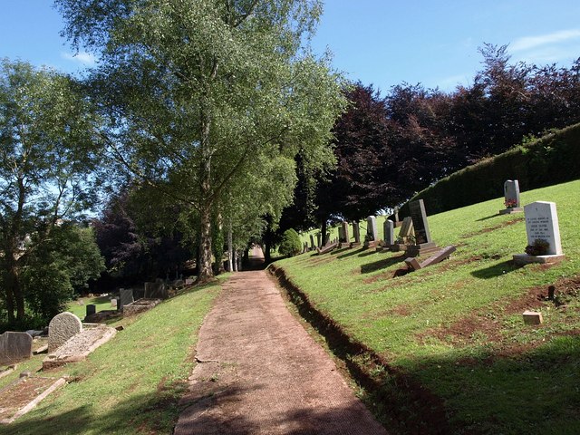
Torquay cemetery
A steeply sloping part of the northern cemetery which was created during the war as an extension to the C19 Barton Road site, this shows the Roman Catholic section in the cemetery. Thanks to JohnC for the information.
 Map © Crown Copyright")
TIP: Click the map for more Large scale mapping
- Grid Square
- SX9066, 976 images (more nearby 🔍)
- Photographer
- Derek Harper (more nearby)
- Date Taken
- Wednesday, 15 July, 2009 (more nearby)
- Submitted
- Thursday, 16 July, 2009
- Subject Location
-
OSGB36:
 SX 9044 6633 [10m precision]
WGS84: 50:29.1904N 3:32.7434W - Camera Location
-
OSGB36: SX 9042 6635
- View Direction
- East-southeast (about 112 degrees)