2009
SX6774 : Higher Sherwell
taken 15 years ago, near to Babeny, Devon, England
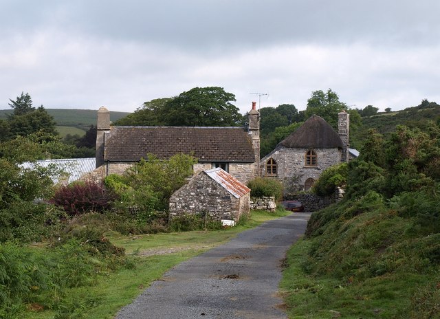
Higher Sherwell
With its pointed-arched windows, the C19 Hornet's Castle, past the barn and farmhouse, is a listed building Link . See also SX6774 : Hornets Castle and SX6774 : Hornets Castle.
 Map © Crown Copyright")
TIP: Click the map for more Large scale mapping
- Grid Square
- SX6774, 47 images (more nearby 🔍)
- Photographer
- Derek Harper (more nearby)
- Date Taken
- Monday, 20 July, 2009 (more nearby)
- Submitted
- Tuesday, 21 July, 2009
- Subject Location
-
OSGB36:
 SX 6795 7485 [10m precision]
WGS84: 50:33.5067N 3:51.9359W - Camera Location
-
OSGB36: SX 6799 7479
- View Direction
- North-northwest (about 337 degrees)