2005
SU8780 : Old Clergy House, Boyn Hill
taken 19 years ago, near to Maidenhead, Windsor And Maidenhead, England
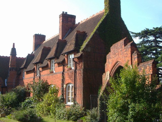
Old Clergy House, Boyn Hill
This forms the western side of the quadrangle of Church Close, of which SU8780 : All Saints Church, Boyne Hill forms the north. "Added by G E Street in 1859 at right angles to and adjoining Parish Centre north side" Link , which implies that this was originally Boyn Hill Infants School. On the right is the stepped entrance gateway to the close Link .
 Map © Crown Copyright")
TIP: Click the map for more Large scale mapping
- Grid Square
- SU8780, 60 images (more nearby 🔍)
- Photographer
- Derek Harper (more nearby)
- Date Taken
- Friday, 9 September, 2005 (more nearby)
- Submitted
- Wednesday, 29 July, 2009
- Subject Location
-
OSGB36:
 SU 8773 8084 [10m precision]
WGS84: 51:31.1806N 0:44.2184W - Camera Location
-
OSGB36: SU 8773 8085
- View Direction
- SOUTH (about 180 degrees)