2009
NT6947 : Blackcastle Rings Earthwork
taken 15 years ago, near to Halliburton, Scottish Borders, Scotland
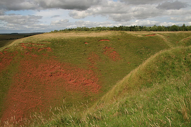
Blackcastle Rings Earthwork
A view over Deil's Neuk to the ancient earthworks on the east side of the Blackadder Water.
 Map © Crown Copyright")
TIP: Click the map for more Large scale mapping
- Grid Square
- NT6947, 11 images (more nearby 🔍)
- Photographer
- Walter Baxter (more nearby)
- Date Taken
- Saturday, 1 August, 2009 (more nearby)
- Submitted
- Saturday, 1 August, 2009
- Subject Location
-
OSGB36:
 NT 6936 4785 [10m precision]
WGS84: 55:43.3854N 2:29.3610W - Camera Location
-
OSGB36: NT 6929 4778
- View Direction
- Northeast (about 45 degrees)