2009
NH5167 : Estate Boundary Fence
taken 15 years ago, near to Allt Nan Caorach [water Feature], Highland, Great Britain
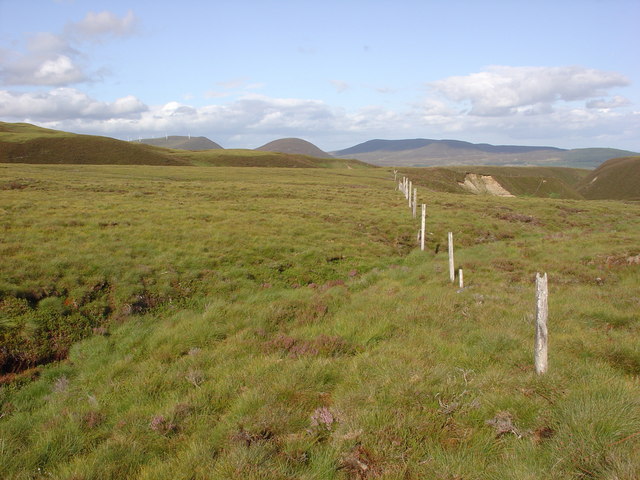
Estate Boundary Fence
The old estate boundary fence runs north east, above the ravine formed by the east flowing Allt nan Caorach river.
The conical hill in the centre of the background, is Meall an Tuirc, 496m. To its left and also above Glen Glass, is Bendeallt, 565m, on which a wind farm is situated.
The conical hill in the centre of the background, is Meall an Tuirc, 496m. To its left and also above Glen Glass, is Bendeallt, 565m, on which a wind farm is situated.
 Map © Crown Copyright")
TIP: Click the map for more Large scale mapping
- Grid Square
- NH5167 (more nearby 🔍)
- Photographer
- Alasdair MacDonald (more nearby)
- Date Taken
- Thursday, 30 July, 2009 (more nearby)
- Submitted
- Sunday, 2 August, 2009
- Subject Location
-
OSGB36:
 NH 517 673 [100m precision]
WGS84: 57:40.2861N 4:29.2361W - Camera Location
-
OSGB36: NH 515 672
- View Direction
- East-northeast (about 67 degrees)