2009
SH8722 : Near the top of Cwm Llwydd
taken 15 years ago, 5 km SW of Ty-Nant, Gwynedd, Wales
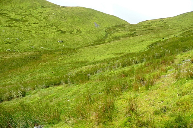
Near the top of Cwm Llwydd
A path up the valley peters out near the bwlch (col) between Foel Hafod-fynydd and the Arans. Heading up, it is still just about discernible here, but the bwlch has become the obvious target anyway.
 Map © Crown Copyright")
TIP: Click the map for more Large scale mapping
- Grid Square
- SH8722, 16 images (more nearby 🔍)
- Photographer
- Graham Horn (more nearby)
- Date Taken
- Thursday, 30 July, 2009 (more nearby)
- Submitted
- Monday, 3 August, 2009
- Subject Location
-
OSGB36:
 SH 870 228 [100m precision]
WGS84: 52:47.4709N 3:40.5771W - Camera Location
-
OSGB36: SH 871 229
- View Direction
- South-southwest (about 202 degrees)