2004
SX8138 : Hallsands
taken 20 years ago, near to Hallsands, Devon, Great Britain
This is 1 of 6 images, with title Hallsands in this square
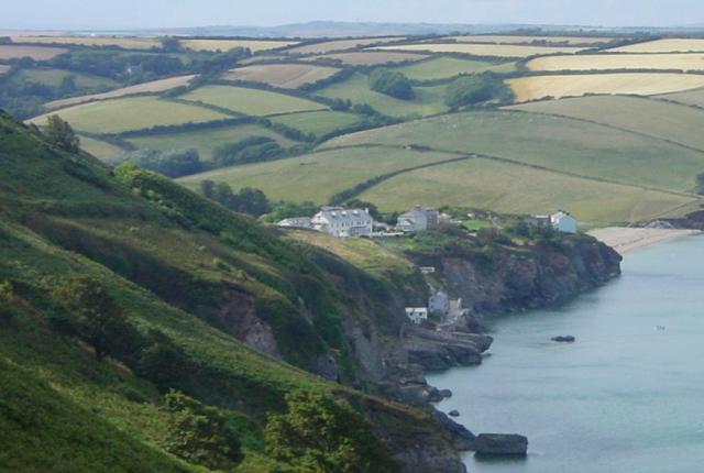
Hallsands
Most of the village of Hallsands fell into the sea one stormy night in 1917. Remains of this lost village may still be seen at low tide. Royal Naval dredging was blamed for the tragedy and much of the coast is now protected with rip rap.
 Map © Crown Copyright")
TIP: Click the map for more Large scale mapping
- Grid Square
- SX8138, 92 images (more nearby 🔍)
- Photographer
- Penny Mayes (more nearby)
- Date Taken
- Sunday, 18 July, 2004 (more nearby)
- Submitted
- Tuesday, 5 April, 2005
- Subject Location
-
OSGB36:
 SX 817 386 [100m precision]
WGS84: 50:14.1317N 3:39.6089W - Camera Location
-
OSGB36: SX 821 375
- View Direction
- North-northwest (about 337 degrees)