2006
NZ2585 : The 'White House'
taken 18 years ago, near to Guide Post, Northumberland, England
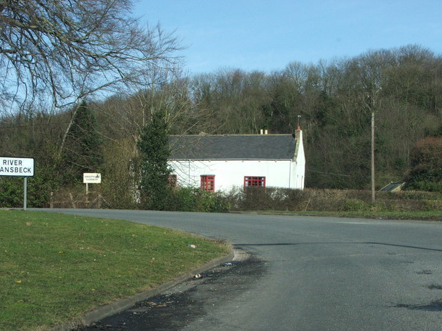
The 'White House'
Situated at the bottom of Sheepwash Bank before the bridge over the River Wansbeck.
 Map © Crown Copyright")
TIP: Click the map for more Large scale mapping
- Grid Square
- NZ2585, 29 images (more nearby 🔍)
- Photographer
- Christine Westerback (more nearby)
- Date Taken
- Monday, 6 March, 2006 (more nearby)
- Submitted
- Saturday, 1 April, 2006
- Subject Location
-
OSGB36:
 NZ 25 85 [1000m precision]
WGS84: 55:9.7901N 1:36.0775W - Camera Location
-
OSGB36: NZ 256 856