2009
NH4963 : Eastwards to Cioch Mhor
taken 15 years ago, 3 km from Heights of Brae, Highland, Scotland
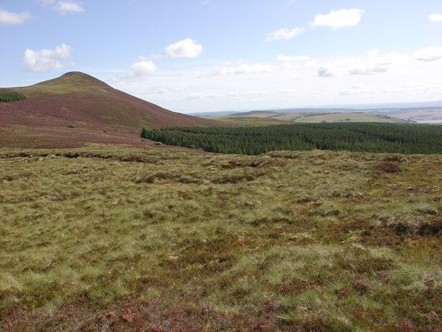
Eastwards to Cioch Mhor
The hill on the left is Cioch Mhor, 482m. The smaller hill in the top centre is Cnoc a' Breacaich, 339m. It is above Dingwall and is known locally as Tulloch Hill. The Cromarty Firth is just visible in the top right of the photograph.
 Map © Crown Copyright")
TIP: Click the map for more Large scale mapping
- Grid Square
- NH4963 (more nearby 🔍)
- Photographer
- Alasdair MacDonald (more nearby)
- Date Taken
- Monday, 24 August, 2009 (more nearby)
- Submitted
- Monday, 24 August, 2009
- Subject Location
-
OSGB36:
 NH 498 634 [100m precision]
WGS84: 57:38.1379N 4:30.9891W - Camera Location
-
OSGB36: NH 493 633
- View Direction
- EAST (about 90 degrees)