2005
TF1307 : Maxey Cut
taken 19 years ago, near to Etton, Peterborough, England
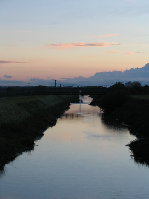
Maxey Cut
Maxey cut is a drainage channel taking water away from the River Welland, returning it after the river passes Market Deeping and Deeping St. James. You can also see water being drained from the neighbouring gravel pits being added.
 Map © Crown Copyright")
TIP: Click the map for more Large scale mapping
- Grid Square
- TF1307, 22 images (more nearby 🔍)
- Photographer
- James (more nearby)
- Date Taken
- Sunday, 22 May, 2005 (more nearby)
- Submitted
- Thursday, 2 June, 2005
- Subject Location
-
OSGB36:
 TF 138 072 [100m precision]
WGS84: 52:39.0684N 0:19.1452W - Camera Location
-
OSGB36: TF 140 072
- View Direction
- WEST (about 270 degrees)